3D Graphics Projects/Consulting/Investigations
This page documents projects that I have done outside of the my current work, typically because I want to investigate an algorithm/technique, or I have
seen something in a 3D demo/app/game and need to know how it works. Some projects
have been done at the request of people I know in the industry.
They are listed in no particular order. Some of these projects a on-going, some are never ending, while others have been completed. Some of these are very old but have been left here due to the number of people who still reference them.
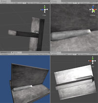
Real-Time Modeling Tools
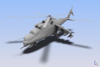
developed for GEO.
Carbon Graphics, developer of GEO, ships one of these plug-ins as part of its base modeler.
Click Here to see more information about the plug-ins.
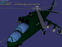
Virtual Welding Simulation
Unity3D Welding Simulation.
Click Here to see information about the virtual welding project.
OpenSceneGraph
GEO Loader for OpenSceneGraph.
Click Here to see more information about the GEO loader.
Click Here to see information about the virtual welding project.
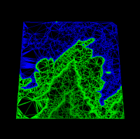
Real-Time Heightmap Shadows

Real-time Heightmap Shadows
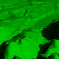
Ambient Occlusion
A rendering of the Ambient Occlusion term
of a PLY file.
Click Here to see more information about the Ambient Occlusion project.
Large Model Visualization

Turbine blade, 1.7 million polygons.
Click Here to see more information about the project.
Progressive Meshing
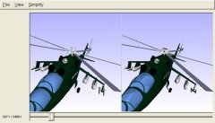
This project involved two phases. Phase 1 was an implementation of a View Independent Progressive Meshing algorithm, working on large polygon count models. The Phase 1 algorithm would only consider the geometric impacts of the collapses in the metric. Phase 1 included a mesh generator which produced a progressive mesh file, and a progressive mesh file viewer.
Phase 2 involved developing an improved algorithm which included support for material attributes in the metric, loading models from 3D Studio and GEO files, and finally a plug-in for GEO.
Update: Project page updated with support for display on Nintendo DS.
Click Here to see the project page.
Texture Atlas Generation
A portion of an automatically generated texture atlas.
Click Here to see more information about the project.
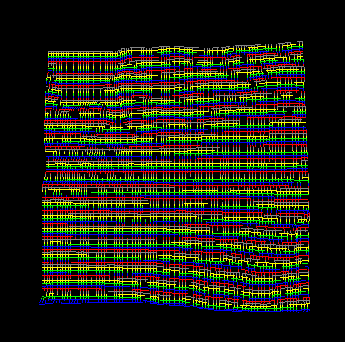
Terrain Studio

Click Here to see more information about the project.
Scene Graph
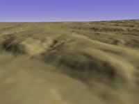 The above terrain was read in from a height map, generated from a DEM file. The shadows/lighting were added
at load time, cutting down the run-time costs. A simple desert texture is applied and a sky dome was added.
The above terrain was read in from a height map, generated from a DEM file. The shadows/lighting were added
at load time, cutting down the run-time costs. A simple desert texture is applied and a sky dome was added.
Click Here to see the project page. This includes a comparison of results from a delauney triangulation and ROAM for terrain rendering in the scene graph.
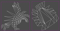
Iterative TIN Generation
Click Here to see more information about the Iterative TIN project.
Vector Product Format (VPF)
Click Here to see more information about the VPF project.
Subdivision Surfaces
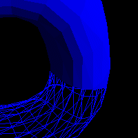
A cutaway view of a torus produced after a couple levels of subdivision.
Click here to see the project page.
Real-Time Renderman / Renderman for Cg
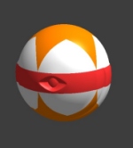 A Renderman procedural shader running in real-time, displaying the legendary Pixar beach ball,
shaded on the Nvidia Shaderball!
A Renderman procedural shader running in real-time, displaying the legendary Pixar beach ball,
shaded on the Nvidia Shaderball!
Click Here to see the project page.
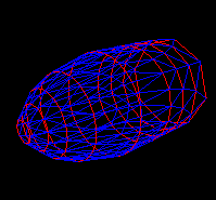
Active Surface Definition (ASD) / Continuous Active Terrain (CAT)
 A morphing level of detail, generated from a height field, displayed using ASD.
Click here to see the project page, including an animation of the ASD morphing terrain.
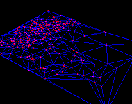
Delaunay Triangulation
 A section of DEM terrain, which uses 16% of the original vertices while still maintaining feature definition.
Click here to read more about this project and for more images.
ROAM Terrain Rendering
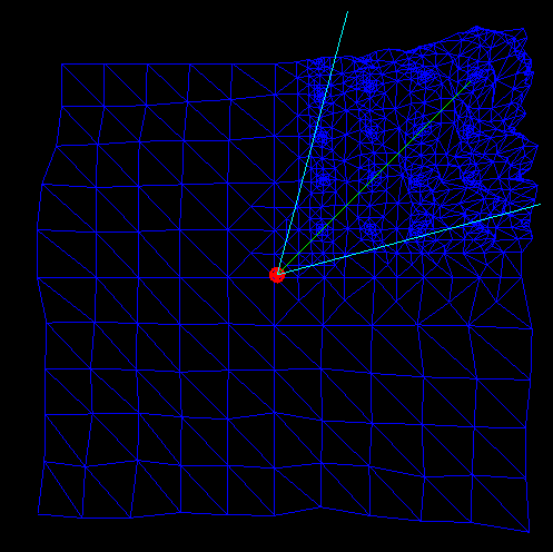 ROAM tessellation - Looking up a mountain in the upper right corner. Eye point and view frustum displayed
as overlays.
ROAM tessellation - Looking up a mountain in the upper right corner. Eye point and view frustum displayed
as overlays.
This stand-alone implementation consists of a split-only implementation, which means the merge and split queues were not implemented. Instead the scene is re-tessellated every frame. The merge and split queues were planned but as many "side-projects" go, they haven't made it yet. Split-only implementations fall apart with dense terrain tessellations. Another limitation to ROAM is that it requires a regular grid terrain, so it can't support TINs.
This implementation was replaced with the implementation that was used in the Scene Graph. (Another split-only implementation.)
Horizon Mapping: Fast Terrain Lighting
 Chagrin River Valley - Cleveland, Ohio DEM file rendered using fragment programs and horizon mapping.
Click here to read more about this project and for more images.
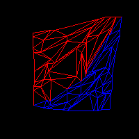
Lofting/Skinning/Surface Reconstruction
 Red contours with a blue triangular mesh generated by the lofting algorithm. Notice the difference in the sizes, and number of segments that make up each contour.
This project also involved developing a plug-in version of the algorithm for the vis-sim modeler Geo.
Click here to read more about this project and for more images.
Quad and Triangle Stripping
 Quad strips generated from a DEM file. No special assumptions made, the loader just dumped quads
into the strip engine then let it find the nice long full terrain wide strips. Alternating colors
are used to show the different strips.
Quad strips generated from a DEM file. No special assumptions made, the loader just dumped quads
into the strip engine then let it find the nice long full terrain wide strips. Alternating colors
are used to show the different strips.
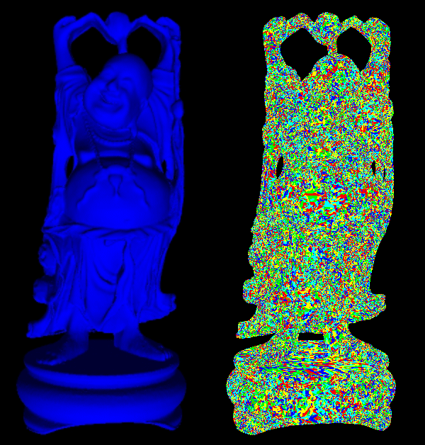
Buddha loaded from PLY, 1.1 million triangles. The left image is the shaded lit original file. The right image is the color coded display of the triangle strips (alternating colors to show the strips.) The stripping version resulted in an average of 4.6 triangles per strip, resulting in approximately 1.7 million less vertex transforms per render.
Some may ask why waste the time, now that hardware can do 25 million triangles per second. To get the full throughput of a graphics chip, the less work it has to do, like transforming an extra million vertices or so, the better off you are. The less data you have to shuttle across the bus, the better also.
For most real world scenarios, it would be better to generate the strips off-line then load the models already stripped. The short-coming being that you can't support dynamic geometry scenarios this way.
PLY Loading - To test the stripping engine better, I wrote a PLY file loader so I could get access to nice big datasets, like Happy Buddha, that aren't as regular as terrain. As can be seen in the image to the right, and the statistics beneath it, the algorithm stands up to a more realistic dataset. I'm sure the dataset could be done with a more optimal set of strips, the algorithm performed quickly and reduced the vertex transform count by 1.7 million vertices (>50%.)
Inverse & Forward Kinematics
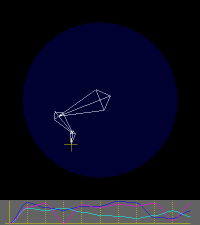 Demo of a 3 jointed arm. The blue circle shows the maximum reach of the arm, and the yellow cross hair is
the target point. The graph at the bottom is of the joint angles interpolated over time.
Demo of a 3 jointed arm. The blue circle shows the maximum reach of the arm, and the yellow cross hair is
the target point. The graph at the bottom is of the joint angles interpolated over time.
Click here to read more about this project and for more images.
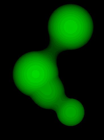
Real-Time Blob Visualization - Aka Lava Lamp
High Level Architecture / RTI

For more information, on this project Click here.