|
|
|
|
Project Goals The goal of this project was to explore both the development of a delaunay triangulation algorithm but also to examine quality simplification algorithms.
Phase 1: Basic Simplification and Delaunay Triangulation
Delaunay Triangulation
"One-pass feature" simplification
|
|
|
Initial Simplification Algorithm A simple algorithm was used to throw out the non-essential vertices: vertices with-in a threshold of the last used vertex (in X & Y) are thrown out. A simple threshold of 3 height units, reduced the terrains greatly. All border vertices are kept so that the algorithm can be used in a tiled height map engine, with causing T-vertices and cracks. The terrain to the right consisted of 22,500 vertices and was reduced to 4,827 with a threshold of 3. This reduced the terrain triangle count from 44k to 9k, almost 1/5th the number of triangles. No information other than differences in height values was used for this metric. It was recognized that an error metric which takes more feature data into account would be necessary but this was the first metric to test the delaunay triangulaiton engine. |
|
|
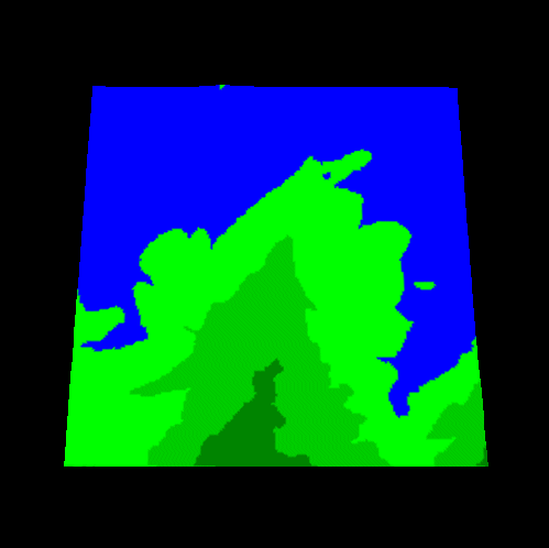
Including Feature Data in the Simplification To improve the potential for a more useable triangulation and simplification, the simplification engine was enhanced. An infinite number of simplification objects can be run on each vertex, outputting a decision to either accept the vertex, reject the vertex, or continue evaluating the vertex with the next simplification object. The initial simplification algorithm was adapted to this new architecture. Coloring based upon height values was also added so we can evaluate how well the algorithm handles feature boundaries. To the right is a larger piece of the terrain run with no simplification. The terrain is rendered solid gouraud shaded triangles, without lighting. |
|
|
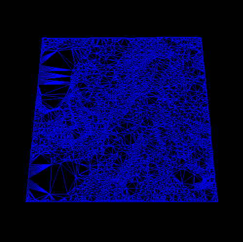
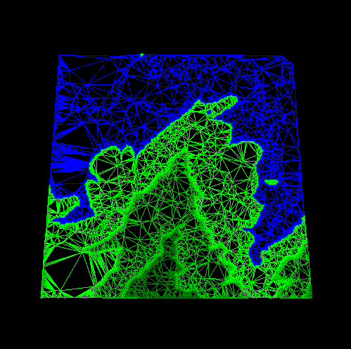
Results from the Basic Simplification Now, the basic simplification algorithm from the first section was run on the terrain. The image to the right illustrates the results when run with a threshold of 8. This was an increase over the threshold used earlier simply to make it more obvious the differences. This simulates the scenarios when a lower polygon count is required. In this case we have reduce the vertex count from 40k to 3328, but at what cost? The shoreline and island have lost quite a bit of definition which would be obvious in a simulation due to the differences in the features. |
|
|
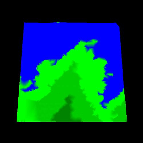
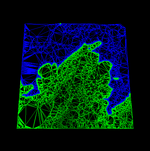
Feature Identification of Coastline The simplification process needs to be able to recognize important features. These include shorelines, roads, mountain peaks, etc. The loss of definition with these features when generating lower levels of detail is obvious and distracting. To enhance the feature representation, I added a Simplification object which detects the transition from the shore to the water. It causes these vertices to be automatically accepted for the triangulation. The results of adding the is simplification object to the process is shown to the right. The vert count has increased from 3328 to 4921 verts but we are still a far cry away from the 40k we started with. Notice the other transitions between colors still show the effects of the basic simplification algorithm. This because we have not tried to preserve them. |

|
|
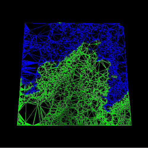
Feature Identification of All Height Color Transitions To examine the vertex impact of this technique, Simplification objects were added for all of the height color transitions. The vertex count increased to 6366 verts from 4921 verts. Though a substantial increase we have preserved the features were desire while using 16% of the original vertices! |

|
|
Phase 1: Summary This simple architecture of multiple simplification objects executing on each vertex to determine whether it contributes to the terrain or not was proven to work quite effectively. Simplification objects for maintaining continuity, mountain peaks, roads, building locations, etc could easily be added. These objects could easily draw upon information from other databases for making their determinations (like where buildings are located.) With these techniques, restrictions on acceptible vertices could be automatically (or manually) loosened for lower and lower levels of detail of the terrain.
Phase 2: Constrained Delaunay Triangulation
Phase 3: Iterative TIN, Local Error Metric, & RMS
References:
|